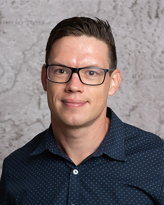
Mgr. Radek Barvíř, Ph.D.
Assistant professor, coordinator of international mobility
Phone: +420 585 63 4583
Email: radek.barvir@upol.cz
Office number: 2.25
Consulting hours: by appointment
ORCID | Web of Science | ResearchGate | ResearcherID | GoogleScholar
Scientific focus:cartography, map complexity, 3D printing, 3D modelling
-
2017–2021, Geoinformatics and cartography (PhD), Palacký University Olomouc
Dissertation: Graphic map load metrics based on raster formats (web)2015–2017, Geoinformatics (masters), Palacký University Olomouc
Diploma thesis: 3D printing of tactile maps linkable with mobile devices (web)2012–2015, Geoinformatics and geography (bachelors), Palacký University Olomouc
Bachelor thesis: Implementation of 3D printing for creating physical terrain and surface models (web)INTERNSHIPS
2021 (03–05), DORA+ Short Term mobility, University of Tartu, Tartu, Estonia
2020 (03), CEEPUS Short Term mobility, Óbuda University Budapest, Székesfehérvár, Hungary
2019 (11), 5th AGILE PhD School 2019, University of Tartu, Tartu, Estonia
2019 (04-05), Spatial Information Management (AKTION research internship), Fachhochschule Kärnten, Villach, Austria
2017 (05), GeoServices-4-Sustainability (GeoS4S ERASMUS+ summer school), Asian Institute of Technology, Bangkok, Thailand
2016 (08-12), Geomatics (Erasmus+ study internship), Norwegian University of Science and Technology, Trondheim, Norway
-
2021–now, assistant professor in the field of advanced visualisation and cartography, Palacký University
2023–2024, cartographer & educator, Urban Planner s. r. o.
2020–2021, cartographer, Urban Planner s. r. o.
2018–2021, researcher, Univerzita Palackého
2017, analysis and digitizing of intravilan area, Urban Planner s. r. o.
2015–2017, 3D printing operator, UPrint 3D, The Science and Technology Park of UP
2015–2016, 3D printing specialist, member of the project research group TouchIt3D – Proof of Concept
2015, work experience during study, Prusa Research s. r. o.
-
2022–now, member of the Czech Cartographic Association
2017–2020, vice-president of Czech Quidditch Association
-
Principles of Geovisualization (KGI/XGPG) – practical training
Thematic Cartography (KGI/XGTC) – lectures and practical training
Systematic Geovisualization (KGI/XGSG, KGI/SYKAR) – systematic visualisation, digital atlases (in English and Czech)
Advanced Visualization (KGI/XGAVM, KGI/VIZUL) – lectures and practical training (in English and Czech)
Geoinformatics in Crisis Management (KGI/GIKRI) – lectures and practical training (in Czech only)
Cartographic Project (KGI/KAPR) – practical training (in Czech only)
Fundamentals of Cartography for Ecologists (KGI/ZKE) – practical training (in Czech only)
Geographic Cartography (KGI/GEOKA) – generalisation, map load, 3D in cartography
Digital Cartography (KGI/DIGKA) – designing 3D maps and tactile maps
SUPERVISED THESIS (written in English)
Henry (2024): Colour 3D-printed geovisualization
Bilal (2024): Using geotagged photos to design Etosha NP map set
Šramo (2023): Automation of processing GNSS track records for designing intensity maps
-
Web of Science (Jimp)
Books (B)
Year Citation 2021 Burian, J. a kol. (2021): Atlas Moravskoslezského kraje: lidé, podnikání, prostředí. Olomouc: Urban Planner, s. r. o., pro Moravskoslezský kraj, 2021. 89 s. ISBN 978-80-270-9454-7 Other
-
-
Year Category Name 2020 Nmap The phenomenon of brain drain in Olomouc - Outflow of human capital from Olomouc to Czech municipalities in 2001-2020 2020 Nmap Predictive archaeological map 2019 Nmap Heuristic map of archaeological sites