Summary
 This Master thesis is a final conclusion of the Geoinformatics Master degree study programme at department of Geoinformatics, Faculty of Science, Palacky University in Olomouc.
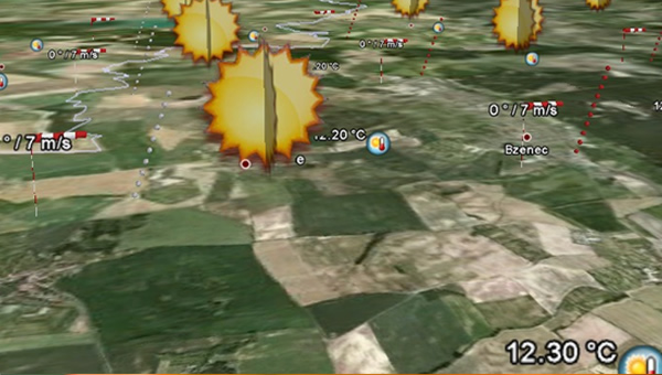
The main goal of the thesis was to create an internet application for a detailed 3D view of the air space to inform the pilot immediately before his flight. The created application displays the required information for the flight process at the appropriate time - above all, meteorological data, air space and airport data. Accessibility of the application is provided through the use of the API technology and a combination of other tools.
The accompanying notification contains information about methods which were applied during the process of programming the application and summarized description of progress of work. The thesis presents chosen programming environment and it’s cooperation with other online technologies and it also involves discussion over chosen procedures and tools.
After an initial analysis of the available tools for 3D worlds imaging, we chose to create the application using the GoogleEarth API technology which represents geospatial data in a suitable way and enables the making of the changes needed according to the requirements of the author. The regular update of the programme components and the base data is another advantage of the chosen method. The terrain surface particularly, within the processed area of the Czech Republic, is of the required accuracy.
The created internet application serves better pre-flight preparation of pilots and confirms the fulfilment of the objectives of the thesis. It shows the effective possibilities of the combination of the technologies and methods used. For a more succesful presentation of the results in the eyes of the public, the SpyFly name was chosen for the application. It will be put under this name on the internet as an extension of the Flymet project. The application received high praises already in the course of testing, and so there are great hopes for its further development.
