SUMMARY
This bachelor thesis describes results of geodetic survey in the Kenický meander and periodic-river Kenická smuha. The area of interest is located in Protected Landscape Area Litovelské Pomoraví as part of National Natural Reservation Ramena řeky Moravy (Channels of Morava river) and Natural reservation Kenický. There was made two data collections of meander from autumn 2011 and spring 2012 and one of Kenická smuha from autumn 2011. Surveying was focused on bank line, channel bars, bank failures and woody debris and accumulation. Eleven transverse profiles of river was created of geodetic leveling survey.
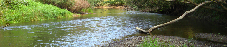
First part of thesis is issue introduction of fluvial geomorphology and woody debris. Every river has morphological effect to its floodplain. There is some methodical approach of river channel classification. This classification has some parameters and one of them is meandering. Meanders has several types of migration and development. Most important process of river evolution is neck cut-off of meander. Also this happened in Kenický meander in spring 2012. In the Litovelské Pomoraví has Morava river natural channel pattern and there is also woody debris in the channel. It enhances the ecological status of the river and ecosystem of river with high amounts of woody debris show higher habitat and species diversity.
In thesis was investigated historical line of water channels by historical maps and historical airborne photography in the area of interest. After georeferencing of the historical photos was created historical bank lines of Morava river between 50's of 20th century and beginning od 21st century. River was affected by humans in the late 19th century, when was cutted-off double meander before today's Kenický meander. Reaction of higher energy in river started evolution of Kenický meander.
From obtained data by surveying was created situation maps before and after cut-off of the meander neck this maps are available as annex of thesis. Comparison of transversal profiles shows immediate start of sedimentation (area and maximum depth of the profiles was less) in old river channel and horizontal and vertical erosion of channel after meander ex-neck.
Location and quantity of woody debris was also changed. A part of Kenická accumulation was carried off by the spring flood and SWD with rubbish from accumulation was blocked downstream about 330 m. To the meander's neck fell down several trees, whose root ball prevent erosion of banks and trunks contribute to vertical erosion (channel in former neck is nearly 5 m depth).
Last chapter is devoted to the periodic rivers and pools (smuha). It's typical morphological form of anastomosing rivers and basic presumption of function performance of floodplain forests. From surveying of Kenická smuha was created DEM. To creation entered 1 109 basic (geodetical accuration) points and 2 943 complementary (calculated from raster) points. For DEM creation was used TIN method. Here used solution is suitable for planar parts of channel bed. For rugged parts is necessary more geodetically surveyed points to achieve the same accuracy as non-rugged parts.
Kontakt:
Otmar PETYNIAK
