ANOTATION
The aim of this bachelor thesis was creating a climbing guide using modern visualization methods. 3D models of rock formations were used, together with elements of virtual reality and augmented reality. A web-based climbing guide was created for the areas of Prachovské skály rock town and Malá Studená dolina valley in High Tatras.
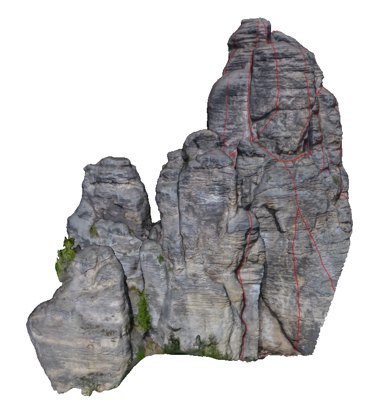
During creation of the guide, 3D models made using photogrammetry and from data from laser scanning were used. Climbing routes were drawn into the models and the models were uploaded onto the web service Sketchfab. During the creation of the models a wide range of software has been used, the most import being: Agisoft Metashape, Meshlab and Cloud Compare. The service Sketchfab has been used to add other elements into the final models. This service also allows display of models in virtual reality.
The second part of the thesis focuses on augmented reality. The javascript library AR.js has been used, allowing implementation of augmented reality in a web browser. The main goal of the augmented reality app is aiding orientation in rocky and mountainous terrain. The main functionality lies in adding elements around the user into the view of the camera in a mobile phone. In Prachovské skály the user will see the names the rock towers around him. In High Tatras the user will see the names of summits and also a route of ascent up the Lomnický štít mountain.
The main outcome of this thesis is interactive web climbing guide, which merges all the above-mentioned components. The web guide is developed in HTML and uses the W3.CSS framework for styling. All the processed models were placed into it and additional information was added. Access to the augmented reality app is also available through the web guide. Another outcome of this thesis is 3D printed model of the tower Mnich. The model was printed bicolour from PLA material on an Ultimaker 3D printer.